Sanborn Map Company
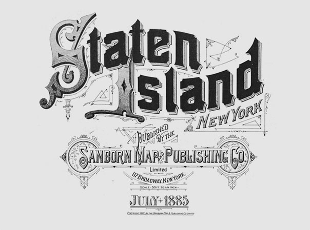
From Christian Annyas, who also heads up the wonderful Movie Title Stills Collection, comes a survey of fire insurance maps from 1885 to 1921 by the Sanborn Map Company. While fire insurance maps may sound like a big snoozefest, don’t be fooled! Christian has great posts of New York maps and images of the different permutations of Sanborn’s own logo on the maps. The lettering on these covers is just beautiful.
Sanborn Map Company began creating fire insurance maps in 1867. They were created to assist insurance agencies in assessing the fire risk of properties. Detailed maps, showing building use, sidewalk and street widths, layout and names, property boundaries, distance between buildings, house and block numbers, location of water mains, hydrants, piping, wells, cisterns, and fuel storage tanks. Maps were often updated by pasting new drawings directly over the original ones.
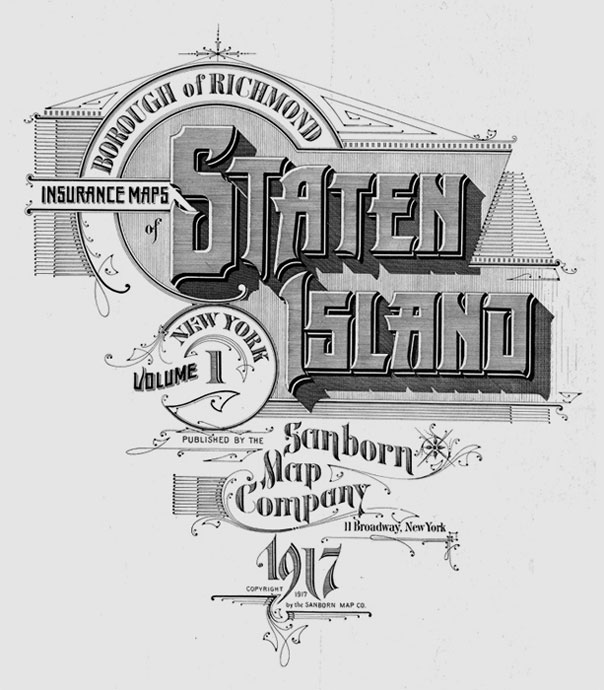
via Christian Annyas


 Designing Interactions